Beta
Beta is simply information, usually regarding the nature of a trip or route and the challenges one might encounter. The word beta sprang from the climbing community and could have originally meant a Betamax video. Essentially the video of someone climbing a pitch.
These days beta typically takes the written form, but you can find excellent route information on YouTube.
Search
This site is currently documenting 11526 locations, with detailed information on 3814 locations.
Ropewiki hosts beta contributed by users but it also aggregates beta documented by other Beta Sites (including guide books).
Information on a specific canyon/cave may be found in many different ways:
- By using the search box in the upper right hand corner (direct search)
- By searching near a geographic location

- By choosing a region of interest

- Browse by name
Contribute
This site relies on users like you to grow and improve. Anyone can add beta or update beta posted by other users. We also welcome links to beta or trip reports posted on other sites.
- Add a new location
- Fix or update existing information
- Define a new region
- How to contribute other content
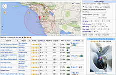
Locations with recent condition reports
Region: United States, Europe, Spain, etc Apply
Recently modified locations
|
|
|
|
|
|
|
|
| |||||||||
|---|---|---|---|---|---|---|---|---|---|---|---|---|---|---|---|---|---|
| 5*#1 | 3B III (v4a2 I) | 7h | 2.2mi | 0.6mi ↕1312ft | 13r ↕131ft | ..., XX., ..., XX. | ||||||||||
| 3*#1 | 2B II PG (v1a2 II) | 3r ↕70ft | ||||||||||||||
| 3.7*#12 | 3C III (v3a3 III) | 4-5h | 9r ↕82ft | XXX, XX., ..., .XX | 24 Dec 2025 | |||||||||||
| 3*#4 | 3A I (v3a1 I) | 2-4h | 0-5r ↕60ft | ..., XXX, ..., ... | 30 Mar 2026 | |||||||||||
| 4.4*#10 | 4C1 III (v4a4 III) | 8h | 9r ↕171ft | XXX, XX., ..., .XX | 20 Apr 2025 | |||||||||||
| 4*#1 | 3C1 III (v4a4 III) | 5r ↕98ft | XXX, XX., ..., .XX | |||||||||||||
| 0*#0 | XXX, XX., ..., .XX | |||||||||||||||
| 3*#3 | XXX, XX., ..., .XX | |||||||||||||||
| 0*#0 | XXX, XX., ..., .XX | |||||||||||||||
| 3.3*#4 | 3C1 III PG (v4a4 I) | 5-7h | 5r ↕131ft | XXX, X.., ..., .XX | 26 Jan 2026 | |||||||||||
| 0*#0 | 3C I PG (v4a1 I) | 3r ↕60ft | XXX, XXX, X.., ..X | |||||||||||||
| 4*#25 | 3C2 II (v3a5 II) | 3-5h | 1.2mi | 0.4mi | 4-6r ↕100ft | ..., XXX, XXX, XX. | 28 Mar 2026 | |||||||||
| 3.9*#53 | 3C II (v3a4 II) | 3.5-5h | 5.1mi | 1r ↕60ft | ..., XXX, ..., ... | 28 Mar 2026 | ||||||||||
| 1.5*#26 | 3B III (v3a2 III) | 4-8h | 5.8mi | 9r ↕260ft | 28 Mar 2026 | |||||||||||
| 3.7*#9 | 3C I PG (v4a3 II) | 1.5-3h | ↕600ft | 1-5r ↕115ft | XXX, XXX, X.., ... | 27 Mar 2026 |
Canyon mapper
RopeWiki hosts a tool that allows the user to plot the elevation profile of a canyon simply by ctrl-clicking (⌘-clicking) on the top of that canyon. The accuracy depends on the character of the canyon and the quality of elevation data in the region. In the San Gabriels, this tool is extremely accurate -- accurate enough to distinguish most rappels and their heights in most canyons. For slot canyons in remote areas of Utah, it is worthless.
This tool works by measuring the 3D polygons automatically loaded onto the viewer's local machine when viewing a particular area with the Google Earth plugin. This means that getting the best results requires:
- Waiting for the Google Earth data to fully load before measuring an elevation profile
- Ensuring that the entire canyon is visible on the screen (off-screen areas are replaced with much lower-resolution polygons and will not yield good elevation profile results)
- Zooming in as much as possible (when zoomed out away from a given area, Google Earth loads lower-resolution polygons because the higher-resolution ones are unnecessary to create a good visual image)
Waterflow gauges
Some canyons with flowing water have gauges installed and managed by agencies/utilities. Some of these gauges are connected live to the internet and some aren't. A wish list of gauges for creeks you'd like to see gauged or gauges needing live connection is kept here.